I wanted to do a multi-day hike in Taiwan, and so off we went.
Budget: JPY13,500 (~USD90)
- JPY2,000. Taipei <> Hsinchu Station
- JPY3,000. Shuttle, Hsinchu <> Gwanhu Villa (NT$300 one way - NT$100 via reservation, ND$200 cash when boarding)
- JPY4,000. Jiujiu Cabin, 2 nights (NTD$200 per night)
- JPY4,500. 1 dinner / 1 bfast at Jiujiu cabin (NT$900 : NT$500 for dinner, NT$400 for breakfast)
- Extras coz I live in Tokyo:
- JPY70,000. Flight. Tokyo to Taipei.
- JPY9,000. Hotel in Hsinchu (JPY18k divided by two people)
Hike Date / Difficulty (Elevation: 3,492m / 11,457ft)
- Hike Date : January 24-26, 2025
- Difficulty: 4 out of 5. Extremely long, but not technical.
- Route below is around 56.4kilometers, with an elevation change of ▲4,178m/ ▽4,177m (22h26m). It's primarily divided as follows (one way, lots of ups and downs and these are my estimates). It's very hard as we didnt have an online map like yamap, but the entire trail is marked with 0.1-0.2km markers, so it's easy to see where we were, distance wise.
- 17.5km, about 400m elev loss. Forest Road to Madara Creek Trailhead. Took us 4.5 hours.
- 4km, about 1,000m elev gain. Ascent to Jiujiu Cabin. Took us 3.5 hours. (going down took us 2 hours)
- 7.5km, about 2,000 elev gain. Ascent to Dabajian. Took us 4 hours with a lot of breaks.
- Here's my friend's yamap log.
When to GoThroughout the year, but do check the shuttle and lodge availability before you book.
Special Notes- The logistics was mainly guided by this blogpost, so big thanks to them.
- BEFORE you book anything, get the permit first. Here's the permit link for the Daba Peaks Trail.
- It gets confusing, so just note that you are doing Shei-pa National Park, Daba Peaks trail from Madara Creek Trailhead. The route we did is : (grade 4) Daba Peaks Trail
- We used the Standard Application because the foreign application requires 65 days advance application. Even then, Normal application requires 5 days in advance application. We needed a TW bank account to do the transfer, so you'll need a TW based contact, but that's probably because we didn't do the foreigner route.
- Permit needs to be printed in 2 copies. One you will submit at entry, another to be on hand just in case it gets checked. And if you leave the trailhead during office hours, it WILL get checked because people are manning the checkpoint.
- There are also other reservations available : bike rental to cycle the 17km forest road, food at JiuJiu cabin, sleeping bag rental at Jiujiu cabin. This was toooooo much for us to organize (plus they may or may not require local bank transfer and for sure require Chinese language ability), so we decided to walk the 17km and carry our own food + sleeping bag.
- Water source : there's multiple water source on the way, but they are NOT recommended for drinking so bring a filter if you want to use them. Otherwise, the water source is ONLY at Jiujiu hut.
- Weather forecast: English
- Trailheads. There are two, and the one I will share is 3d2n, while the other one is 4d3n, I was told. I didnt ask the details for the other one.
- Guanwu villa (觀霧山莊). Google maps actually work.
- Train to Hsinchu Station.
- Shuttle, Hsinchu Station to Guanwu Villa. Boarding is at #5, on the far end. Here's the gmaps pin. Exact cash needed (they will not give change otherwise), or your easy card.
- This is a ride that will challenge your stomach. DRINK antimotion sickness medicine beforehand.
- Reservations may be needed if you come at peak season - book here. Choose 新竹高鐵站 to 觀霧山莊
- There's only one shuttle with about 10-15 people capacity, so definitely try to reserve. In our case, we went in winter so it's low season and people were able to board without reservation.
- Mountain huts.
- Paid. Jiujiu Cabin. Reservations made when you book your mountain permit.
- Free. We saw three along the way.
- Near KM17 marker hut. Pics below.
- Madara Creek Hut. After doing the looooong 17/19km walk is a hut prior to the Jiujiu cabin assault. People who cannot book Jiujiu cabin stay here.
- Jhongba Hut.
Itinerary
Friday- 07:10am. Shuttle, Hsinchu Station to Guanwu Villa.
- 09:38am. Arrived at Guanwu Villa bus stop. We walked to Guanwhu Villa which apparently was the wrong way. The right way was the reverse. You're trying to go here.
- 10:06am. We got back to the Guanwu Villa bus stop and started walking the right direction lol
- 10:08am. Arrived at point 0km of the forest road.
- 10:13am. Arrived at the checkpoint where we had to drop off one copy of the hiking permit.
- 02:08pm. Arrived at the first free hut.
- 02:35pm. Arrived at the 17km marker.
- 02:51pm. Arrived at the Madara Creek Hut.
- 02:55pm. Arrived at point 0km of the Jiujiu Cabin assault.
- 05:40pm. Arrived at Jiujiu Cabin. Checked in. This is when my friend realized she didnt have enough food, so we decided to ask the cabin folks if we can buy food there, and we decided Saturday's breakfast and dinner will be with them and we'll save our food.
Saturday- 06:00am. Breakfast.
- 07:00am. Headed out for the hike
- 09:58am. Arrived at Jhongba Hut.
- 10:50am. Arrived at Dabajian Peak. We did try to see the trail to Shobajian, but it's way too dangerous with icicles hanging overhead + steep snow + trail I couldn't even see as it was covered in snow. Plus, plenty of the trails coming to this point was icy, and well, I dont need the extra adrenaline.
- 11:15am. Started heading back.
- 11:26am. Decided to stop and have lunch. We headed out and decided to do the other peak. By around 1pm things have started to be cloudy so we skipped the other summit and headed straight to Jiujiu cabin.
- 03:01pm. Back at Jiujiu Cabin.
Sunday- 03:06am. Started the hike. No breakfast. T.T
- 05:10am. Back to the 17km marker. The shortcut to 17km marker is a bit hard to see, so be alert after you cross the bridge. It's right before the Madara Creek Hut I think. If you pass the hut, you've missed it. Look for the pink ribbons.
- 05:40am. Finished breakfast and headed out again.
- 09:45am. Back at the checkpoint.
- 09:56am. Back at the shuttle.
- 10:10am. Shuttle, Guanwu Village to Hsinchu Station.
- 12:30am. Back at Hsinchu Station!!!
 |
The bus stop at Hsinchu Station. It's the platform on the far end.
|
 |
| Boarding at Platform 5. |
 |
| Inside the shuttle. |
 |
| The restroom break in the middle of the shuttle ride of hell. |
 |
| So we saw this and went straight to Guanwu Villa. But the actual way is actually the opposite. |
 |
| The shuttle stop. |
 |
| A view of Guanwu Villa - this is the WRONG way. |
 |
| The right way is up this road. |
 |
| Look for this entrance. This is 0km point. |
 |
| Signs to Dabajian Mountain. |
 |
| Warning + map at the entrance. |
 |
| 0km point. |
 |
| Another parking lot - if you have a car, this is where you can park instead of Guanwu Village. |
 |
| Dropping the permit at the post near the window. |
 |
| Ok time to hike! |
 |
| Need to pass through the gate. |
 |
| Plenty of warning. |
 |
| This is life for the next 17kms. |
 |
| I think there are two toilet stops : near the 5km and 10km marks. |
 |
| Plenty of parking for cyclists too. |
 |
| Toilets are furnished with a nice flush + nice facial tissues. But no extras, so I wonder how often they check the supplies. |
 |
| Some natural water sources. |
 |
| Plenty of these stone tables + chairs on the way, but I dont know how anyone can sit and use the table at the same time. Is it for giants? |
 |
| One nice waterfall on the way. |
 |
One hut near 17km marker.
|
 |
| Inside the hut. |
 |
| There's a little water source near the hut - see that white little thing? There's a pipe from the waterfall flowing to there. |
 |
| 17km point! There's a shortcut to skip km18-19 at the left of this picture. |
 |
| The hut at Madara Creek Trailhead. |
 |
| Saw some people with motorbikes. We met 3 staff carrying some load from Jiujiu hut, so maybe it's for them? |
 |
| Crossing the bridge. |
 |
| It all resets to zero! 0km point to Jiujiu hut. |
 |
| Remnant of the old bridge nearby. |
 |
| 0.1km! Whew. Yes, there's a marker for almost every 0.1-0.2km. |
 |
| And the trail is very stone + roots denominated. |
 |
| Tropical forest! |
 |
| I feel like the Chinese is saying quite a bit and the English was too simplified.... |
 |
| This was very soft and nice to our feet. |
 |
| 4km marker! |
 |
| and here's Jiujiu hut!!!! |
 |
| Soooo happy. |
 |
| Is that a curtain designed after the 500 nt$ bill??? |
 |
| Our home for the night. |
 |
| With some nice padding. |
 |
| Heading out for Day 2. |
 |
| Staaaairs. |
 |
| Morning had a clear weather while afternoon was cloudy. This was consistent on the three days we were hiking. |
 |
| Around 5km is when the snow started. |
 |
| Beautiful view while hiking. |
 |
| More snow. |
 |
| The covered areas saw more snow + some ice. |
 |
| Our first sight of Dabajian. |
 |
| Finally some trails above treeline. |
 |
| Jhongba hut. |
 |
| Just one big room. |
 |
| Much snowier trails. |
 |
| This was likely the most sketchy section. It's a narrow trail. |
 |
| Looking back at the trail. |
 |
| Beautiful view of Dabajian! |
 |
| Finally got to the foot of this rock. Unfortunately we cannot summit this piece of rock. |
 |
| Looking at the surrounding area. |
 |
| Time to say goodbye. |
 |
| Apparently this is the spot for the copy of the money. |
 |
| Gorgeous gorgeous gorgeeeeeous. |
 |
| Got a lot cloudier in the afternoon. |
 |
| The way down of the extra summit we did. |
 |
| The other summit. |
 |
| The clouds have started coming in. |
 |
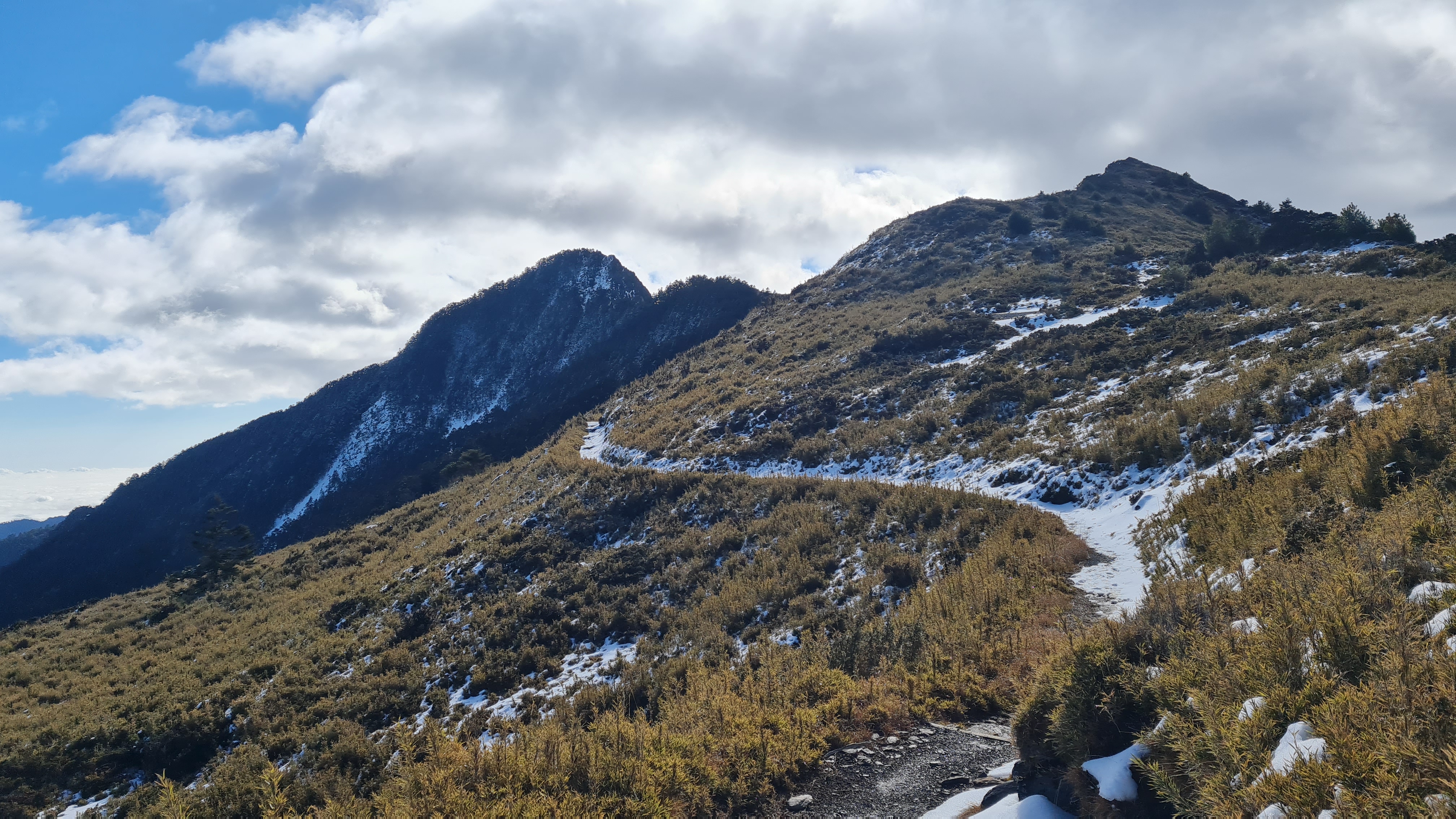
| Looking back at the beautiful ridge that we crossed. Had to go down, go across the mountains and go up. |
 |
| The last push up - you can see the trail up. |
 |
| The next fork for the summit. Since it's all cloudy we decided to skip it. |
 |
| Back at Jiujiu hut. |
 |
| Here's a pic of the dinner we had. |
 |
| A pic of the breakfast. |
 |
| What it looks like inside the small huts in Jiujiu hut. |
 |
| Heading out for Day 3. |
 |
| Back at 17KM marker where we decided to take a break and have breakfast. |
 |
| The 17km marker. |
 |
| The toilet near the 10kM marker. |
 |
| Back at the entrance! |
 |
| The hut was there waiting, and left on time. |
 |
| I decided to have a massage after the hike. At NT$1,800, it's not cheap but I do want a massage to take a break. |


Comments
Post a Comment
Comments are like mail in my postbox. Such a nice surprise. ^__^