Mt. Arashima is an unexpectedly challenging enough hike, with gorgeous views of Hakusan on one side, and Mt. Ibuki on another.
Budget: JPY16,000 (~USD135) from Tokyo Station
- JPY1,720. Train, Fukui Station <> Kadohara Station (JPY860 one way)
- or JPY5,000, share in car rental etc.
- JPY8,000. Night bus, Tokyo < > Fukui Station
- JPY3,000. Hostel near Fukui Station.
Hike Date / Difficulty (Elevation: 1,523m / 4,997ft)
- April 17, 2022
- Difficulty: 3 out of 5.
- Route below is around 8.6kilometers, with an elevation change of ▲1,272m/ ▽1,272m
- Map Link
 When to Go
Throughout the year, but prepare for snow during winter.
We went in April where there was still plenty of snow, though some parts had none, so I had to put on and take off my crampons a couple of times.
Special Notes- This is a "piston hike", meaning one straight ascent. There's a brief descent from Shakunage-daira (シャクナゲ平), but other than that it was a consistently steep hike up to reach the summit (at least from Kadohara Station trailhead).
- Weather forecast: Japanese.
- Trailheads. There are three main trailheads, all of them I'm going to refer to by the name of the closest train station.
- The first access point is to get to Fukui area. I took an overnight bus from Tokyo to Kanazawa Station, as there are more buses going to Kanazawa than Fukui.
- The buses normally leave Tokyo around 10pm to midnight, while the return bus arrives around 6am. It costs JPY4,000~ one way. I used this site to search for the cheapest bus and booked from there.
- Kadohara Station (勝原駅). It's 1.1kms to the trailhead (google maps pin), which is around 20 minute walk.
- Train from Fukui Station is JPY860 one way.
- Car navigation wise, I inputted "Kadohara Station". There are two parking spots at the trailhead, one at the side of the mountain and the other right across for overflows.
- Shimoyuino Station (柿ヶ島駅). It's 2.8kms to the trailhead (google maps pin), which is around 50minute walk.
- Train from Fukui Station is JPY860 one way.
- Echizen-shimoyama Station (越前下山). Right at the trailhead.
- Train from Fukui Station is JPY990 one way.
Train schedule, Fukui Station <> Trailheads above
- Mountain huts.
- Paid: None.
- Free: None.
- Camping: There is a camping spot near the trailhead - 勝原園地 (maps pin). This is 750meters away (10minute walk) from Kadohara Station.
- Wild camping wise, Shakunage-daira (シャクナゲ平) halfway up Kadohara trailhead and the summit might be a decent spot.
Itinerary - via car rental Hike seems to take
6-7 hours during summer, and one log for winter took them 7.5hours
Friday
- 10:20pm. Bus, Tokyo to Fukui Station
Saturday
- 06:25am. ETA: Fukui Station
- Explore Noto Peninsula
Sunday
- Drive from Fukui Station to Kadohara Station (one hour ish)
- Hike Mt. Arashima (6 hrs ish?)
- 09:30pm. Bus, Fukui Station to Tokyo.
Monday
- 06:30am. ETA: Shinjuku Station.
Actual Log - via car rental
Friday
- 11:00pm. Bus, Tokyo to Kanazawa Station. I wanted a bus to Fukui, but the buses were full when I booked. The bus was NOT a nice bus, just a normal 4 seater one.
Saturday
- 07:35am. Arrived at Kanazawa Station.
- Explored Noto Peninsula, drove to Fukui Station.
Sunday
- 07:30am. Started driving from Fukui Station to Kadohara Station trailhead.
- 08:30am. Arrived at trailhead, geared up and started hiking. It started with a short, steep walk up the concrete path, then some switchbacks up a gravel? rocky? trail up.
- 09:13am. Arrived at the official trailhead, which was the top of a the old ski lift.
- 11:04am. Arrived at the fork - Shakunage-daira (シャクナゲ平). It was covered in snow, but given the "平 part of the fork, I assume it's a flat enough spot for people camping. From here I turned left, looking at the summit. (spoiler alert : it was not the summit). I had to go down a bit, and then it was back to the steep ascent.
- 12:27pm. Arrived at the summit with gorgeous views of Hakusan.
- 01:04pm. Started the descent.
- 04:31pm. Back at the car, tidied up, and drove back to Kanazawa Station to catch our bus.
- 10:30pm. Bus, Fukui Station to Tokyo.
Monday
- 06:30am. Arrived at Tokyo Station. Went to work, where I slept in and missed Monday morning work (my boss called my personal phone asking me if I did not fall off a mountain! T.T)
 |
| Kanazawa Station on a dreary morning. |
 |
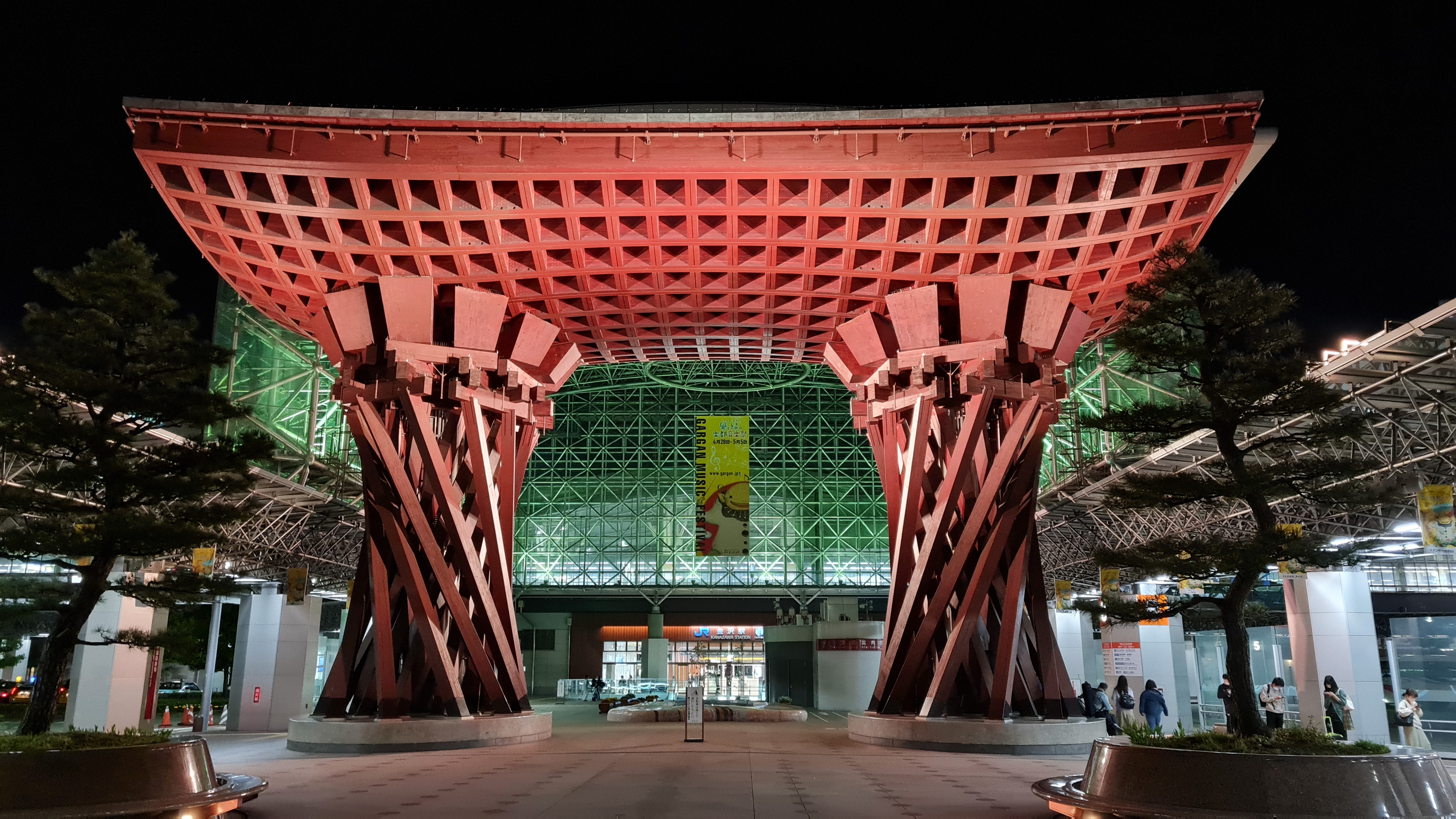
| Kanazawa Station on a clear night. |
 |
| The trailhead near Kadohara Station. There's a toilet that's closed in winter, a "phone booth" where hikers should register their hikes, and a huge parking lot (maybe for 40 cars?) |
 |
| Supposedly open at April, but we got there April 18 and it was closed. |
 |
| The parking lot. I see 10 ish cars here, then 4 rows, so 4x10 maybe 40 slots? There is an "overflow" parking right across though. |
 |
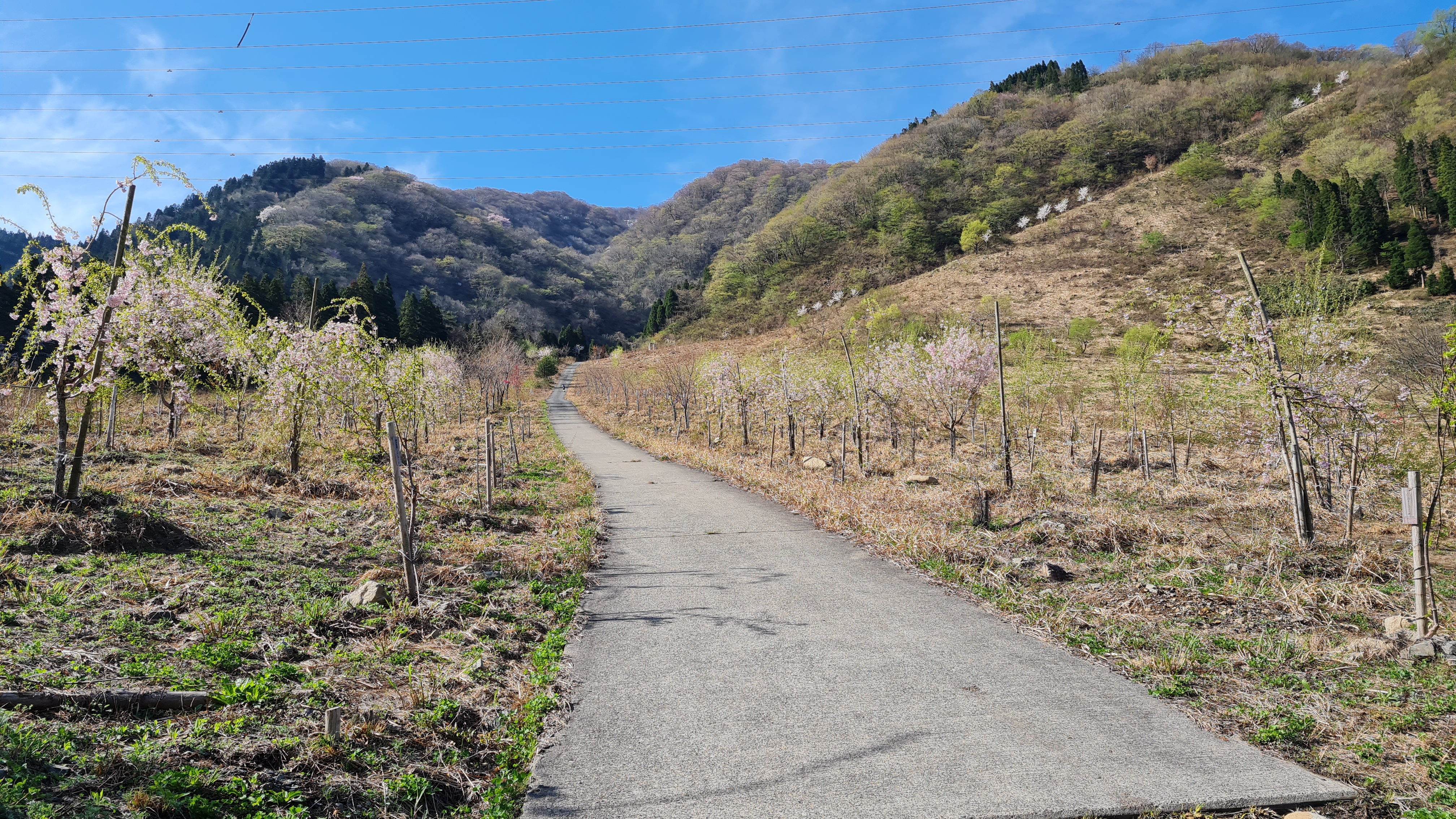
| The first part of the hike is going up this concrete. |
 |
| Then some switchbacks up here. |
 |
| Gravelly / rocky (?) trail? |
 |
| The top of an old lift, which is the official trailhead. |
 |
| The sign that says this is the trailhead. |
 |
| Pretty pretty trees in the hike. |
 |
| 2km to the summit!!! |
 |
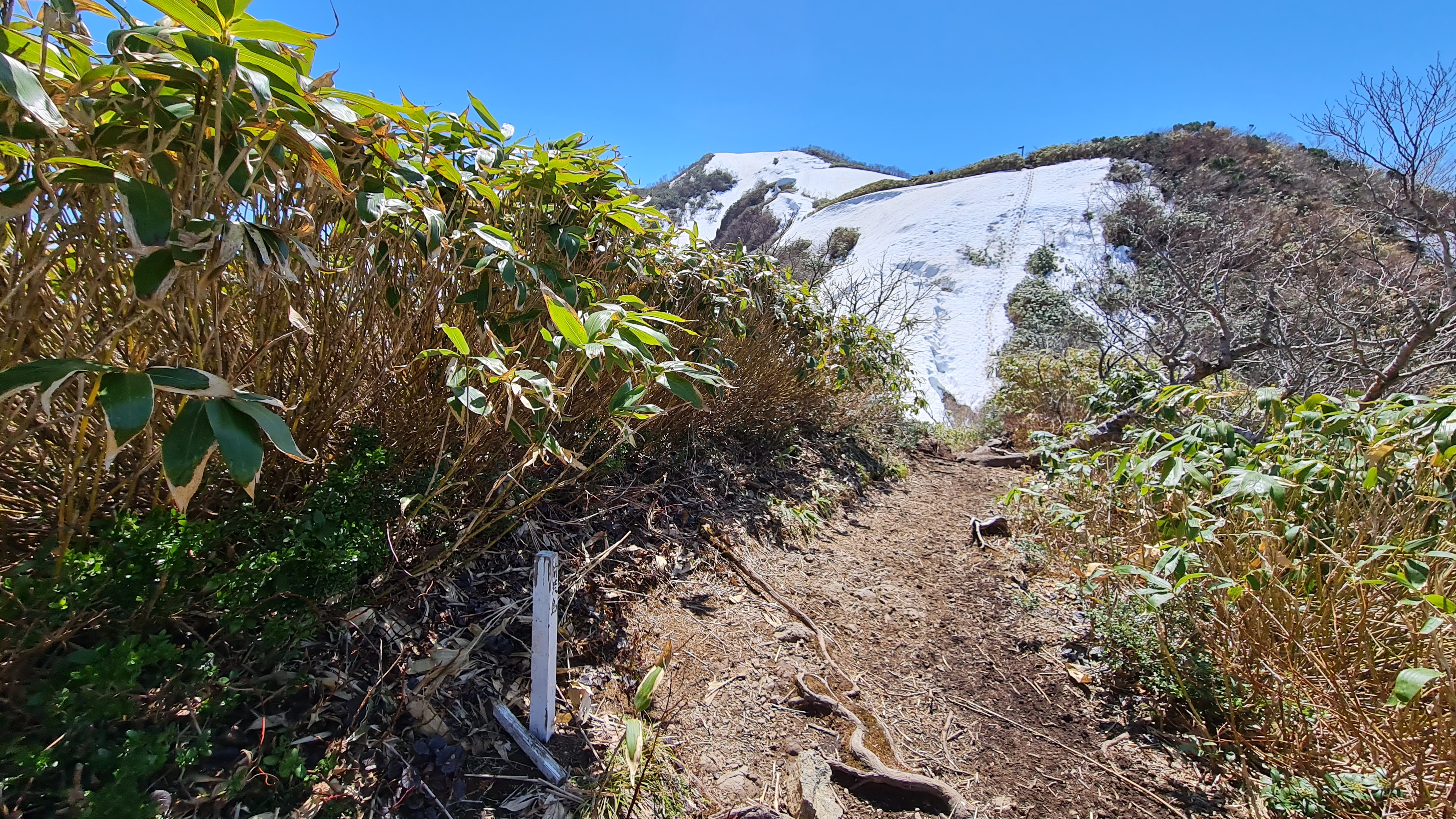
| Soon got into the snowy section of the trail, and we had to put our crampons on. |
 |
| Shakunage-daira (シャクナゲ平). |
 |
| Summit from Shakunage-daira (シャクナゲ平). Spoiler alert - it was not. |
 |
| The 前荒島岳. Like a pre-summit. |
 |
Or a baby Arashima?
|
 |
| Ugh. See that trail in the snow? It was easy enough to go up, but going down I slid 2/3 of the way. Should have taken my ice axe so I could have had self arrested. But this is the only section I felt like I needed to use an ice axe. |
 |
| It was a gentle slope from there on, except for a short push to the summit. |
 |
| Yes, gentle slope. |
 |
| Summit!!! |
 |
| Going back down. |
 |
| My friend sliding down. |
 |
| Almost back to the car. This is the gravelly / rocky trail I'm saying. |
 |
| Aaaaaalmost! Yey! |


Itinerary (via public transport from Fukui Station)
ReplyDelete- 09:08am. Train, Fukui Station to Kadohara Station.
- 10:37am. ETA: Kadohara Station. Walk to trailhead.
- 11:00am. ETA: Trailhead. Start hike.
- 03:00pm. ETA: Summit.
- 06:30pm. ETA: Trailhead. Run to the train station.
- 06:47pm. Train, Kadohara Station to Fukui Station.